Barbados vs. St. Lucia: Which Island Has Better Snorkeling?
The Caribbean Snorkel Showdown: Accessible Reefs vs. Volcanic Drama
Choosing the perfect Caribbean snorkelling destination fundamentally relies on understanding geology. On one side of the Tobago Trough, you have the calm, highly accessible artificial reefs and sandy shallows of Barbados. On the other, the steep, dramatic volcanic drop-offs and deeper underwater walls of St. Lucia. This comparative guide is designed for casual snorkellers, free-divers, and marine wildlife enthusiasts trying to decide which island’s underwater topography best matches their skill level and expectations.
While both islands offer spectacular marine life, the stark contrast between Barbados’ white-sand shallows and St. Lucia’s plunging volcanic walls creates two entirely different underwater experiences requiring different levels of water proficiency.
For official travel guidelines and destination overviews, visitors often consult the Saint Lucia Tourism Authority and Visit Barbados websites. However, when it comes to the specific mechanics of snorkelling—visibility, currents, and accessibility—geology dictates the experience. Understanding the bathymetry of each island will determine whether you spend your holiday floating easily over sunken tugboats or kicking hard against currents to view deep-water sponges.
Snorkelling Logistics: Barbados vs. St. Lucia
| Feature | Barbados | St. Lucia |
|---|---|---|
| Geology & Seabed | Coral-limestone, highly reflective white sand | Volcanic, darker grey and black sand substrates |
| Reef Accessibility | Excellent shore access, shallow shipwrecks | Many boat-only drops, steep volcanic walls |
| Water Clarity | High (natural limestone filtration, no rivers) | Variable (impacted by heavy rainforest run-off) |
| Best For… | Casual snorkellers, turtle spotting, beginners | Advanced free-divers, dramatic topography |
The Non-Volcanic Anomaly: Barbados’ Coral-Limestone Base
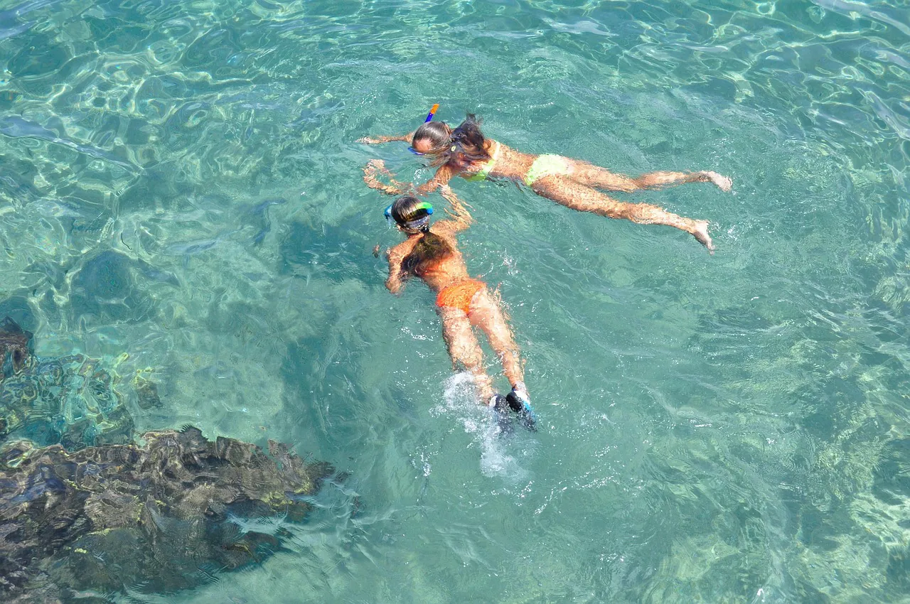
Barbados is a geological outlier in the Lesser Antilles. As the Caribbean’s only non-volcanic landmass, its pale coral-limestone seabed creates a remarkably bright underwater environment. The white sand reflects sunlight, maximising visibility even on overcast days. This high-visibility turquoise hue provides distinct advantages for surface snorkellers who rely on ambient light to view marine life from above, eliminating the intimidating dark blue depths common to volcanic islands.
This bright, shallow environment is exactly what makes Barbados’ best snorkelling spots so appealing to beginners and families. The lack of steep drop-offs means that marine life congregates in easily accessible shallows. Consider the strictly non-motorised Folkestone Marine Park in Holetown. Its designated snorkel trail starts exactly 10 metres from the shoreline. The local bathymetry offers a gentle gradient dropping from 1.5 to 9 metres (5 to 30 feet), providing safe, shallow viewing of Venus Sea Fans and rare Sea Lilies (Crinoids) without the need for a boat charter.
Shipwreck Accessibility: The Carlisle Bay Advantage
The contrast in accessibility becomes most apparent when examining artificial reefs. Barbados offers six distinct wrecks accessible via a simple 200-metre swim from the beach at Carlisle Bay. The most famous is the Berwyn, a 70-foot French tugboat scuttled by its own mutinying crew in 1919. Resting in just 6 metres (20 feet) of water and submerged for over a century, it is the most heavily coral-encrusted wreck in the bay and is fully visible to surface snorkellers.
For those with more breath-hold capacity, the bay also houses the Ce-Trek, a 45-foot derelict vessel made entirely of ferro-cement. Sunk in January 1986 in 12 metres of water, its rough surface provides superior grip for coral attachment, drawing large schools of Parrotfish. Advanced free-divers often target the Eilon, a former drug-smuggling vessel sunk on June 8, 1996, which sits at a maximum depth of 17 metres (55 feet) and features a highly photographed air pocket in its bow. You can learn the exact GPS coordinates and structural details in our comprehensive guide to exploring the Carlisle Bay shipwrecks.
If you prefer a structured excursion over a self-guided swim, booking a catamaran turtle and shipwreck cruise provides professional oversight, buoyancy aids, and immediate access to these wreck sites without the required surface swim.
Hawksbill Turtle Density
Beyond geology, Barbados holds a significant statistical advantage for marine encounters. Through the ongoing conservation work of the Barbados Sea Turtle Project, the island hosts the largest nesting population of critically endangered Hawksbill turtles in the insular Caribbean. Over 600 females are documented nesting on the island annually. This staggering density drastically increases the probability of near-shore encounters compared to St. Lucia. When engaging with these animals, it is crucial to follow local guidelines, which we outline heavily in our turtle etiquette guide.
St. Lucia’s Volcanic Topography & Water Clarity
Steep Slopes and Darker Substrates
In stark contrast to Barbados, St. Lucia is defined by its dramatic volcanic origins, most famously represented by the UNESCO-recognised Pitons. Underwater, this translates to darker grey and black sand bottoms that drastically alter the visual experience. Snorkellers here often find themselves floating over steep slopes and plunging walls that descend quickly into the abyss.
Voted one of the top shore dives in the Caribbean, St. Lucia’s Anse Chastanet house reef perfectly exemplifies this topography. The reef begins a mere 10 yards from the water’s edge. It features a shallow 5 to 25-foot plateau that violently drops off into a solid wall of mixed corals plunging to 140 feet. While this volcanic drama provides a breathtaking backdrop, the darker substrate absorbs more light. This absorption creates a deep-blue underwater environment that can feel intimidating for first-time snorkellers accustomed to brightly lit swimming pools or sandy shallows.
Similarly, snorkelling at Sugar Beach (Anse des Pitons) takes place within a roped-off marine reserve situated directly between the Gros and Petit Pitons. Just past the buoy lines, the reef drops sharply to 130 feet, defined by massive underwater volcanic boulders and vibrant barrel sponges.
Wreck accessibility also differs vastly. St. Lucia’s premier artificial reef, the 165-foot freighter Lesleen M (sunk in October 1986), sits 65 feet deep on a sandy bottom and requires a 15-minute boat ride from Soufrière. It is a spectacular site for scuba divers, but its depth makes it largely inaccessible to surface snorkellers, unlike the shallow wrecks detailed in our ultimate guide to snorkelling in Barbados.
Rainforest Run-off vs. Filtered Limestone
Terrestrial geography plays a massive role in water clarity. St. Lucia’s towering, lush mountains receive significant rainfall, leading to nutrient-rich rainforest run-off. During wet seasons, this run-off empties into river mouths and can heavily cloud coastal waters, temporarily reducing visibility to mere metres.
By comparison, Barbados’ relatively flat, porous limestone acts as a giant natural filter. With no major mountain rivers to discharge silt into the ocean, the limestone traps sediment and ensures consistently high visibility. This is particularly reliable during the dry season, a phenomenon we explain in detail in our best time and weather guide for snorkelling.
To protect its fragile, nutrient-rich volcanic reefs, St. Lucia established the Soufrière Marine Management Area (SMMA) in July 1995. Visitors entering these marine reserves for snorkelling must pay a daily Coral Conservation Fee. This is typically $1 to $5 USD for individual access, or up to $15 USD when bundled into boat tours, strictly enforced and collected by local Park Rangers.
For naturalists willing to hire a boat and pay the SMMA fees, sites like “Coral Gardens” at the base of St. Lucia’s Gros Piton offer dense sea plume forests in the shallows. The area is renowned for sightings of the unusual Sargassum Triggerfish. However, locating these specific sites requires local knowledge, making guided excursions far more of a necessity in St. Lucia than the easily navigable, self-guided shorelines of Barbados.
Making Your Decision: Which Island Wins?
The decision between Barbados and St. Lucia ultimately comes down to your priorities in the water. If your goal is to experience dramatic, plunging walls, deep-water barrel sponges, and a rugged volcanic backdrop, St. Lucia is an exceptional destination for advanced free-divers and scuba enthusiasts. The marine management in Soufrière has cultivated a highly protected environment, provided you are comfortable with darker waters and steep drop-offs.
Conversely, if you prioritise consistently clear visibility, independent shore access, and the ability to view historic shipwrecks and endangered sea turtles with minimal effort, Barbados remains unparalleled. The island’s unique coral-limestone base creates a welcoming, illuminated underwater arena that caters flawlessly to casual snorkellers and families. To seamlessly integrate these accessible reef experiences into your holiday, consider booking a glass bottom boat excursion or arranging private guided tours and lessons upon arrival.